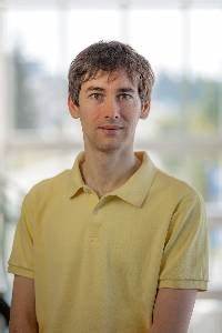
报告人:Simon Zwieback(助理教授)
 时间:2022.10.21 9:00-10:30
Zoom会议:830-038-80399
密码:见邮件或班级通知
报告人简介
Simon Zwieback is an assistant professor of remote sensing at the Geophysical Institute and the Department of Geosciences, University of Alaska Fairbanks. He obtained the PhD degree in Environmental Engineering from ETH Zurich, Switzerland, in 2016. He uses remote sensing to characterize and understand land surface processes in permafrost regions. By combining remote sensing advances with field observations and models, he aims to quantify and predict permafrost terrain dynamics. Simon currently acts as PI on three projects funded by NASA and other US federal agencies. He is the first author of more than 25 papers in remote sensing and cold-regions land surface processes. He has been serving the scientific community through co-leading a T-MOSAiC Action Group on permafrost thaw, serving on the editorial board of the IEEE Transactions on Geoscience and Remote Sensing, and co-organizing the 16th International Circumpolar Remote Sensing Symposium.
报告简介
Remote sensing and geospatial technologies are essential for mapping Arctic permafrost dynamics. Changes in climate and disturbance regimes can rapidly destabilize Arctic landscapes underlain by ice-rich permafrost. In hilly landscapes, slumping and gullying driven by thaw of ice-rich permafrost can mobilize large amounts of organic carbon, potentially accelerating climate change. However, we lack quantitative estimates of these terrain changes and their impact on the carbon cycle. I will outline the potential of radar and optical remote sensing for quantifying permafrost terrain changes. To provide a specific example, I will focus on the northern Taymyr Peninsula, Russia, where thaw slumps are prevalent. I will show results obtained from repeated TanDEM-X satellite radar observations, documenting a recent acceleration in thaw slumping. Colleagues and I inferred an approximately 40-fold increase in the slump-induced volumetric changes from 2010-2017 to 2017-2021. This increase was largely due to the initiation of new slumps. Initiation mainly occurred in the extreme warm year of 2020, according to annual Sentinel-2 images. To estimate the release of organic carbon from thermokarst, these remote sensing data sets need to be combined with maps of soil organic carbon content. I will describe the geospatial modeling behind such large-scale mapping, focusing on the difficulty of obtaining reliable uncertainty estimates. The estimated carbon mobilization rates increased by a factor of 25 to 31 from 2010-2017 to 2017-2021. Comparison with complementary pan-Arctic data sets indicates that thaw slumps have become a major component of the regional carbon cycle on the Taymyr Peninsula. However, the observational and epistemic uncertainties are substantial, highlighting knowledge gaps that will need to be addressed to better constrain the changing Arctic carbon cycle.