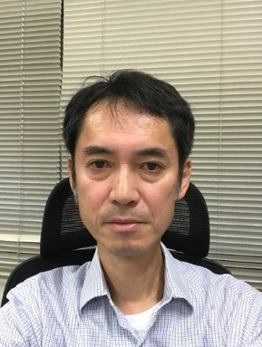
 报告人:Masato Furuya(日本北海道大学 教授)
时间:2024年9月24日(周二)15:00-16:30
地点:测绘馆401会议室
报告简介:
Space geodetic technique based on L-band microwave is useful not only for surface deformation mapping but also for ionosphere monitoring. Sporadic E (Es) layer is an anomalously high electron density patch that appears at altitudes of ~100 km in the E region of the ionosphere, causing communication problems in the very high frequency (VHF) band, and has been studied for decades. Combining the total electron content (TEC) data from two nationwide Global Navigation Satellite System (GNSS) networks in Japan with the L-band synthetic aperture radar (SAR) data, we reveal the fine spatial and temporal structure of a daytime Es episode in Shikoku, Japan. The snapshot of the Es is derived not only from interferometric SAR (InSAR) but also from multiple aperture interferometry (MAI), the latter of which performs better in isolating the fine spatial structure.
报告人简介:
Masato Furuya is a professor at Department of Earth and Planetary Sciences, Hokkaido University, Japan. His research interests are applications of space geodetic data, including InSAR and GNSS, to a variety of geophysical modelling and observations, including earthquakes, volcanic activities, glaciers, permafrost, and atmosphere. He received PhD from the University of Tokyo in 1997 on the Chandler wobble excitation. In recognition of his outstanding and broad research in geodesy and geophysical interpretation of data and results, he was awarded the 2007 Guy Bomford Prize from International Association of Geodesy. He has also served on the Editorial Boards of a couple of international journals dealing with geodesy and geophysics. He has been one of the two Member-At-Large of IAG Executive Committee and also been an associate member of Science Council Japan.