| 姓名: | 乔刚 | |
| 性别: | 男 | |
职称: |
教授 ,博士生导师 | |
籍贯: |
山东淄博 | |
邮箱: |
qiaogang@tongji.edu.cn | |
简介: |
发表中英文学术论文100余篇,其中SCI论文50余篇;主持国家自然科学基金项目6项,国家重点研发计划项目二级课题4项,国家科技部高端外国专家项目和人社部外国专家项目各1项,上海市自然科学基金项目1项和国际科技合作项目1项;授权国家发明专利8项,获国家级教学成果奖二等奖、省部级优秀教学成果奖一等奖和省部级科技进步奖三等奖;国际SCI期刊《Marine Geodesy》助理编辑(2014-);国际冰川学会IGS会员、国际冰冻圈科学学会IACS会员、国际IEEE地球科学与遥感学会会员、美国摄影测量与遥感学会会员、南极研究科学委员会SCAR RINGS行动计划小组成员、国际数字地球学会ISDE中国国家委员会数字极地专业委员会委员、中国冰冻圈科学学会CSCS(筹)极地冰冻圈专业委员会委员,曾任国际摄影测量与遥感学会 “冰冻圈与水圈”工作组秘书(2016-2022)。本人参加中国第35、36次南极科考,指导的研究生4人参加中国第38、39、40、41次南极科考,1人参加瑞典北极格陵兰科考和韩国ARAON多国(瑞典)南极科考(科考照片和视频见本页面底部)。 |
|
学习和工作经历
研究方向
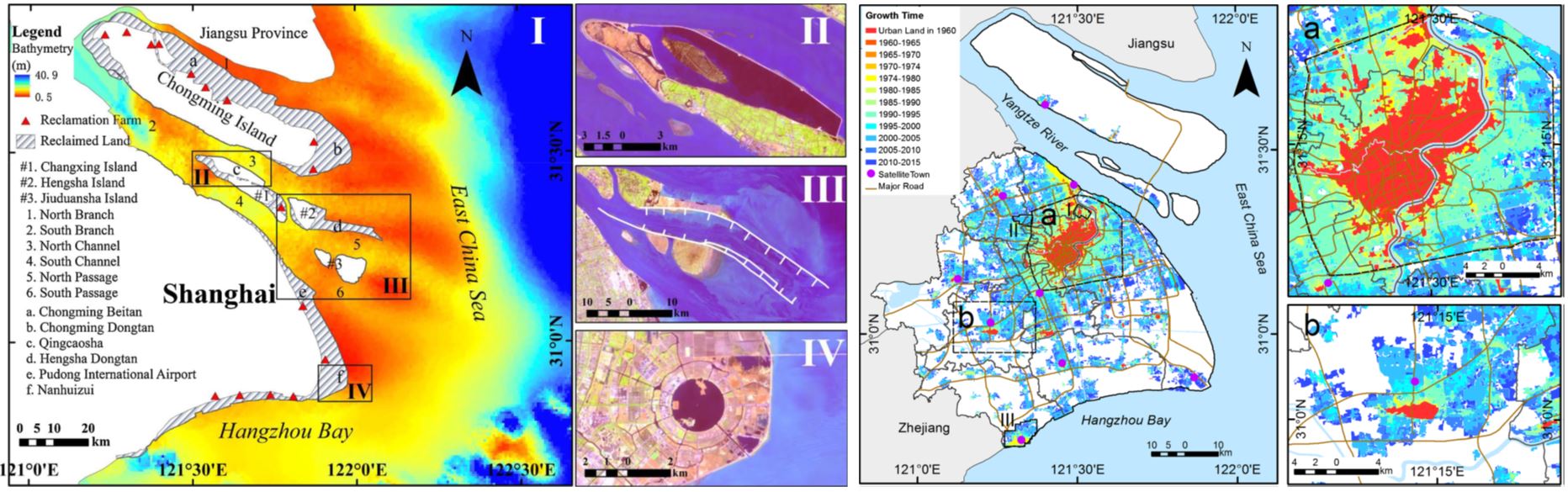
加入我们 欢迎对测绘遥感感兴趣的同学加入本课题组攻读博士和硕士研究生,本课题组正在承担多个国家级重点项目,可为研究生提供良好的学习与科研环境,以及国际交流和极地考察机会。课题组理念:勤奋、务实、为科研奉献,促进学生成长。 联系人:乔刚 电话:13818426779(微信同号) 邮箱:qiaogang@tongji.edu.cn 主讲课程 本科生课程:测量学,测量学B,测量实习,测绘VB,测绘编程语言,测绘程序设计与开发,测绘编程实践,低空无人智能测绘,地理信息系统,地图学概论 研究生课程:智能测绘研究方法,测绘科学与技术进展,测绘重大工程案例分析,智能测绘与工程案例分析 主要科研项目 1. 南极冰盖冰下不稳定性及对物质平衡的影响研究,国家外国专家局外国专家项目(H20240381),2024.01-2025.12,主持 2. 南北极和高亚洲测绘遥感与气候变化国际研讨会,国家自然科学基金专项项目(4244200177),2024.08-2024.12,主持,已结题 3. 国产自主卫星强化观测技术与全球山地冰川贡献量估计新方法,国家自然科学基金重大项目“海平面上升的多圈层作用机制与预估”子课题(42394131),2024.01-2028.12,主持 4. 南极冰下湖长时序遥感观测建模及其对冰盖物质平衡的影响研究,上海市科技创新行动计划国际科技合作项目(23230712200),2023.09-2026.08,主持 5. CHINARE地面观测协同的新型光子测高卫星南极冰盖变化稳定性方法研究,国家自然科学基金面上项目(42276249),2023.01-2026.12,主持 6. 全球生态环境遥感监测2023年度报告—南北极与青藏高原冰雪变化及影响,国家遥感中心项目(2022-NRSCC-047),2022.08-2023.12,参加,已结题 7. 南极冰盖不稳定性过程的国际合作研究,国家科技部外国专家项目(G2022133035L),2022.01-2023.12,主持,已结题 8. 1960年以来雅鲁藏布江源区关键要素多源遥感观测与径流反演,上海市自然科学基金面上项目(22ZR1464700),2022.04-2025.03,主持,已结题 9. 冰冻圈表层关键过程监测,国家科技部重点研发计划项目二级课题(2021YFB3900105-3),2021.12-2025.11,主持 10.星-空多源遥感观测与海底AUV协同的西南极Thwaites冰川不稳定性研究,国家自然科学基金国际(地区)合作研究与交流项目(42111530185),2021.01-2024.12,主持,已结题11. 基于无人机遥感的冰川微地形建模与演化分析——以东南极拉斯曼丘陵区域为例,国家自然科学基金国际(地区)合作研究与交流项目(42011530088),2020.07-2023.06,主持,已结题 12. 南极冰盖深部结构、冰下过程及其对海平面的影响,国家自然科学基金专项项目(41941006),2020.01-2023.12,课题负责人,已结题 13. 1960年代南极早期卫星影像冰流场重建新方法研究,国家自然科学基金面上项目(41771471),2018.01-2021.12,主持,已结题 14. 研究声光电磁场景建模与集成方法,国家重点研发计划项目二级课题(2017YFB0503502),2017.07-2021.06,主持,已结题 15. 长序列多卫星冰川流速监测及产品研发,国家重点研发计划项目二级课题(2017YFA0603102),2017.07-2022.12,主持,已结题 16. 西南河流源区关键水文气象变量的多源遥感观测与数据集成,国家自然科学基金重大研究计划重点项目(91547210),2016.01-2019.12,课题负责人,已结题 17. 特大城市公共基础设施安全监测技术体系与应急服务,国家测绘地理信息局公益性行业专项项目(201412017),2014.01-2015.12,子课题负责人,已结题 18. 近百年极地冰盖冰架变化对全球海平面上升的总体贡献定量研究,国家重大科学研究计划课题(2012CB957701),2012.01-2016.12,骨干,已结题 19. 集成空天地多源异构多视遥感数据的特大城市超高层建筑物三维重建研究,国家自然科学基金青年项目(41201425),2013.01-2015.12,主持,已结题 20. 极地冰盖变化多传感器网络精密观测与数据处理关键技术,中央高校基本科研预研类项目,2011.01-2013.12,主持,已结题 21. 机载LiDAR辅助的高分辨率卫星立体影像建筑物精确定位与立体提取,同济大学青年优秀人才培养行动计划,2011.01-2013.10,主持,已结题 主要学术兼职 中国卫星导航定位协会低空经济工作委员会委员,2025- 中国测绘学会低空开发与利用工作委员会委员,2025- 中国测绘学会国际合作工作委员会委员,2025- 中国地理信息产业协会第七届理事会遥感影像应用工作委员会委员,2025- 国际冰冻圈科学学会IACS会员,2024- 国际数字地球学会ISDE中国国家委员会数字极地专业委员会委员,2023- 南极研究科学委员会SCAR RINGS行动计划小组成员,2021- 中国冰冻圈科学学会CSCS(筹)极地冰冻圈专业委员会会员,2017- 国际摄影测量与遥感学会ISPRS WG III/9 “冰冻圈与水圈”工作组秘书,2016-2022 国际SCI期刊《Marine Geodesy》助理编辑,2014- 国际冰川学会IGS会员,2013- 国际电气与电子工程师协会IEEE会员,2012- 国际电气与电子工程师协会IEEE地球科学与遥感学会会员,2012- 美国摄影测量与遥感学会ASPRS会员,2009- PERS, IEEE TGRS, Survey Review, IEEE JSTARS, IJDE, JOG等多个国际期刊审稿人 指导学生 在读博士生: 2024级:朱丽,赵亚洲,谢益炳 2023级:瞿植(参加中国第41次南极科考) 2022级:谢陈雨(参加中国第40次南极科考) 2021级:唐乐月,乔月 2020级:王丽娟(新西兰奥塔哥大学联合培养),何正兴 2019级:何有权 2018级:袁小涵(瑞典哥德堡大学联合培养,参加瑞典北极格陵兰科考和韩国ARAON科考船多国(瑞典)南极科考) 在读硕士生: 2024级:陈浩民 2023级:孙超杰,王奥 2021级:曹哲毅(参加中国第39次南极科考) 毕业硕士研究生及毕业去向: 罗鹏澜(2022级):深圳华为云计算技术有限公司 毛琼瑶(2022级):广东大湾区空天信息研究院 于承萱(2021级):哔哩哔哩股份有限公司 林 铠(2020级):漳州市测绘设计研究院 赵浩楠(2019级):北京荣耀终端有限公司 孙子翔(2019级):上海华为技术有限公司 许如国(2018级):南通市自然资源和规划局 陈乐旻(2017级):黄河勘测规划设计院 吴艺君(2016级):上海市地震局 曹雨佳(2016级):绍兴市自然资源和规划局上虞分局 李洪伟(2015级):同济大学读博(参加中国第38次南极科考) 郭 宋(2014级):当家移动绿色互联网技术集团有限公司 张 楠(2013级):国网江苏省电力有限公司经济技术研究院 毕业博士研究生及毕业去向: 李雁君(2017级,比利时布鲁塞尔自由大学联合培养):中山大学博士后 米 环(2015级,美国波士顿大学联合培养):烟台大学任教 主要论文 近期期刊论文: 1. Yuan, X., Sun, Z., & Qiao, G.* (2025). 36-Year Surge Behaviors of the Sortebræ Glacier Complex in East Greenland, Revealed by Multisource Satellite Images. IEEE Journal of Selected Topics in Applied Earth Observations and Remote Sensing, 18, 7509–7528. https://doi.org/10.1109/JSTARS.2025.3546330 2. Boronina, A., Popov, S., & Qiao, G. (2024). On the factors and the degree of their effect on subglacial melt and changes in the state of Antarctic subglacial lakes. Arctic, Antarctic, and Alpine Research, 56(1), 2406622. https://doi.org/10.1080/15230430.2024.2406622 3. Chen, T., Ji, L., Xiao, E., Jiang, C., Huang, Q., Gu, X., & Qiao, G. (2024). An investigation of stress analysis via finite element methods on compacted snow runways. Cold Regions Science and Technology, 225, 104272, 1-10. https://doi.org/10.1016/j.coldregions.2024.104272 4. Li, R., He, Y.*, Li, H., Gu, Y., Li, G., Qiao, G.*, Xie, H., Hao, T., & Cui, X. (2024). A New Model for Elevation Change Estimation in Antarctica From Photon-Counting ICESat-2 Altimetric Data. IEEE Transactions on Geoscience and Remote Sensing, 62, 4301515. https://doi.org/10.1109/TGRS.2024.3395522 5. He, Y., Li, H., Qiao, G.*, Hao, T., Hai, G., Xie, H., & Li, R.* (2024). Validation of ICESat-2 Elevation Accuracy in Antarctica Using CCR Arrays. IEEE Transactions on Geoscience and Remote Sensing. IEEE Transactions on Geoscience and Remote Sensing, 62, 4301317. https://doi.org/10.1109/TGRS.2024.3386781 6. Li, Y., Cui, X.*, Qiao, G.*, Li, L., & Lang, S. (2024). Evaluating and locating a suitable bedrock drilling site near zhongshan station with airborne and ground-based observations. Polar Science, 42(12), 101076. https://doi.org/10.1016/j.polar.2024.101076 7. Tang, L., Qiao, G.*, Li, B., Yuan, X., Ge, H., & Popov, S. (2024). GNSS-supported direct georeferencing for UAV photogrammetry without GCP in Antarctica: A case study in Larsemann Hills. Marine Geodesy, 47(4), 324–351. https://doi.org/10.1080/01490419.2024.2316089 8. Li, R., Cheng, Y.*, Chang, T., Gwyther, D.E., Forbes, M., An, L.*, Xia, M., Yuan, X., Qiao, G., Tong, X., & Ye, W. (2023). Satellite record reveals 1960s acceleration of Totten Ice Shelf in East Antarctica. Nature Communications, 14, 4061. https://doi.org/10.1038/s41467-023-39588-x 9.李荣兴*, 夏梦莲, 谢欢, 郝彤, 乔刚, 刘世杰, 冯甜甜, 田一翔, 安璐*, 童小华, 赵爱国, 李洪伟, 王晓峰, 骆舒蕾, 常甜, 崔浩田, 李国君. (2023). 南极冰盖物质平衡变化的卫星遥感监测现状与发展趋势. 地球物理学报, 66(8): 3115-3143, https://doi: 10.6038/cjg2022Q0213 10. Cheng, Y., Hai, G.*, Cui, X.*, Lv, D., Qiao, G., & Li, R.* (2023). Mass balance of the Antarctic Ice Sheet from 2013 to 2018 estimated using the input-output method with updated remote sensing products. Science China Earth Sciences, 66 (7), 1478-1492. https://doi.org/10.1007/s11430-022-1109-y 11. Zhao, A, An, L.*, Zhang, Y., Wang, H., Li, F., Feng, T., Hao, T., Hao, W., He, Y., Jiang, L., Lu, P., Meng, X., Niu, X., Qiao, G., Ren, X., Shen, Q., Shen, Y., Tian, Y., Wang, Y., Xiao, B., Xie, H., Zhang, S., Zhou, F., Zhou, S., & Li, R*. (2023). The global change and response special project: using remote sensing data to monitor and invert key components in the cryosphere. All Earth, 35(1), 168-182. https://doi.org/10.1080/27669645.2023.2227488 12. Skrypitsyna, T.N., Florinsky, I.V.*, & Qiao, G. (2023). Motion of the Dålk Glacier (Prydz Bay, East Antarctica): Application of unmanned aerial survey. Polar Science, 38(12), 100949. https://doi.org/10.1016/j.polar.2023.100949 13. Yuan, X., Qiao, G.*, & Li, Y. (2023). 57-year ice velocity dynamics in Byrd Glacier based on multisource remote sensing data. IEEE Journal of Selected Topics in Applied Earth Observations and Remote Sensing, 16(3), 2711-2727. https://doi.org/10.1109/JSTARS.2023.3250759 (2023年卷封面文章) 14. Li, Y., Qiao, G.*, Popov, S., Cui, X., Florinsky, I., Yuan, X., & Wang, L. (2023). Unmanned aerial vehicle remote sensing for Antarctic research. IEEE Geoscience and Remote Sensing Magazine, 11(1), 73-93. https://doi.org/10.1109/MGRS.2022.3227056 15. Qiao G.*, Yuan, X., Florinsky, I., Popov, S., He, Y., & Li, H. (2023). Topography reconstruction and evolution analysis of outlet glacier using data from unmanned aerial vehicles in Antarctica. International Journal of Applied Earth Observation and Geoinformation, 117(3), 103186. https://doi.org/10.1016/j.jag.2023.103186 16. Feng, T., Li, Y., Wang, K., Qiao, G., Cheng, Y., Yuan, X., Luo, S., & Li, R.*. (2022). A hierarchical network densification approach for reconstruction of historical ice velocity fields in East Antarctica. Journal of Glaciology. 1-20. https://doi.org/10.1017/jog.2022.58 17. Hao, T., Cui, H.*, Qiao, G.*, Hai, G., Li, H., He, Y., & Li, R.*. (2022). Impact of slope on ICESat-2 elevation accuracy along the CHINARE route in East Antarctica. IEEE Journal of Selected Topics in Applied Earth Observations and Remote Sensing. 15(7), 5636-5643. https://doi.org/10.1109/JSTARS.2022.3189042 18. Qiao G.*, Li, H. (2022). Lake water footprint determination using linear clustering-based algorithm and lake water changes in the Tibetan Plateau from 2002 to 2020. Photogrammetric Engineering & Remote Sensing, 88(6), 371-382. https://doi.org/10.14358/PERS.21-00047R2 19. 李荣兴, 李国君, 冯甜甜, 沈强, 乔刚, 叶真, 夏梦莲. (2022). 基于光学遥感卫星影像的南极冰流速产品和方法研究综述. 测绘学报. 51(6), 953-963. https://doi.org/10.11947/j.AGCS. 2022. 20220168 20. 乔刚, 郝彤, 李洪伟, 陆平, 安璐, 陈秋杰, 李荣兴*. (2022). 全球气候变化背景下极地冰盖关键参数遥感观测验证. 测绘学报. 51(4), 599-611. 21. Hai, G., Cheng Y., Xie H.*, Hao, T., Qiao, G. & Li, R. 2022. Assessment of CryoSat-2 baseline-D height product by GNSS and ICESat-2 in Lambert-Amery system, East Antarctica. IEEE Journal of Selected Topics in Applied Earth Observations and Remote Sensing, 15(3), 2891-2900. https://doi.org/10.1109/JSTARS.2022.3156929 22. Li, R.*, Cheng, Y.*, Cui, H., Xia, M., Yuan, X., Li, Z., & Qiao, G. (2022). Overestimation and adjustment of Antarctic ice flow velocity fields reconstructed from historical satellite imagery. The Cryosphere. 16(2), 737–760. https://doi.org/10.5194/tc-16-737-2022 23. Cheng, Y., Xia, M.*, Qiao, G.*, Li, Y., Hai, G., & Lv, D. (2021). Calving cycle of Ninnis Glacier over the last 60 years. International Journal of Applied Earth Observation and Geoinformation, 105(12), 102612. https://doi.org/10.1016/j.jag.2021.102612 24. 郝彤, 王晓峰, 冯甜甜, 陆平, 乔刚, 谢欢, 李荣兴*. (2021). 地球系统大尺度关键过程的智能观测. 测绘学报. 50(8), 1084-1095. https://doi.org/10.11947/j.AGCS.2021.20210109 25. Skrypitsyna, N. T.*, Zakharov, V., Kiseleva, S. A., Bliakharskii, D., Qiao, G., Yuan, X., & Florinsky, I. (2021) Topography evolution of the Dålk outlet glacier (Prydz Bay, East Antarctica) based on data from unmanned aerial surveys performed in 2017–2019. Geodesy and Aerophotosurveying, 65(5), 517–528. https://dx.doi.org/10.30533/0536-101X-2021-65-5-517-528 26. Li, R., Li, Z., Han, J., Lu, P., Qiao, G.*, Meng*, X., Hao, T., & Zhou, F. (2021). Monitoring surface deformation of permafrost in Wudaoliang Region, Qinghai–Tibet Plateau with ENVISAT ASAR data. International Journal of Applied Earth Observation and Geoinformation, 104(15), 102527. https://doi.org/10.1016/j.jag.2021.102527 27. Cheng, Y., Xia, M.*, Qiao, G.*, Lv, D., Li, Y., & Hai, G. (2021). Imminent calving accelerated by increased instability of the Brunt Ice Shelf, in response to climate warming, Earth and Planetary Science Letters, 572(8), 117132. https://doi.org/10.1016/j.epsl.2021.117132 28. Li, R., Li, H., Hao, T.*, Qiao, G.*, Cui, H., He, Y., Hai, G., Xie, H., Cheng, Y., & Li, B. (2021). Assessment of ICESat-2 ice surface elevations over the Chinese Antarctic Research Expedition (CHINARE) route, East Antarctica, based on coordinated multi-sensor observations, The Cryosphere, 15(7). 3083–3099. https://doi.org/10.5194/tc-15-3083-2021 29. Jin, S., Liu, Y.*, Fagherazzi, S., Mi, H., Qiao, G.*, Xu, W., Sun, C., Liu, Y., Zhao, B., & Fichot, C. (2021). River body extraction from sentinel-2A/B MSI images based on an adaptive multi-scale region growth method, Remote Sensing of Environment, 255(3), 112297. https://doi.org/10.1016/j.rse.2021.112297 30. Mi, H.*, Fichot, C., Bryan, K., Qiao, G.*, & Fagherazzi, S. (2020). Rapid shoreline flooding enhances water turbidity by sediment resuspension: an example in a large Tibetan lake, Earth Surface Processes and Landforms, 45, 3780–3790. https://doi.org/10.1002/esp.5000 31. Lu, P., Han, J., Li, Z., Xu, R., Li, R., Hao, T., & Qiao, G.* (2020). Lake outburst accelerated permafrost degradation on Qinghai-Tibet Plateau, Remote Sensing of Environment, 249(11), 112011. https://doi.org/10.1016/j.rse.2020.112011 32. Qiao, G.*, Li, Y., Guo, S., & Ye, W. (2020). Evolving instability of the Scar Inlet Ice Shelf based on sequential Landsat images spanning 2005–2018. Remote Sensing, 12(1), 36. https://doi.org/10.3390/rs12010036 33. Lu, P., Han, J., Hao, T.*, Li, R.*, & Qiao, G. (2020). Seasonal deformation of permafrost in Wudaoliang basin in Qinghai-Tibet Plateau revealed by StaMPS-InSAR. Marine Geodesy, 43(3), 248-268. https://doi.org/10.1080/01490419.2019.1698480 34. Mi, H., Fagherazzi, S., Qiao, G.*, Hong, Y., & Fichot, G.* (2019). Climate change leads to a doubling of turbidity in a rapidly expanding Tibetan Lake, Science of the Total Environment, 688, 952-959. https://doi.org/10.1016/j.scitotenv.2019.06.339 35. Mi, H., Qiao, G.*, Wang, W., & Hong, Y. (2019). Analysis of urban growth from 1960 to 2015 using historical DISP and Landsat time series data in Shanghai. Arabian Journal of Geosciences, 12(7), 250. https://doi.org/10.1007/s12517-019-4420-2 36. Cui, X., Liu, J., Tian, Y.*, Sun, B., Li, R.*, Markov, A., Lv, D., Hai, G., Qiao, G., Feng, T. (2019). GIS-supported airfield selection near Zhongshan Station, East Antarctica, based on multi-mission remote sensing data. Marine Geodesy, 42(5), 422-446. https://doi.org/10.1080/01490419.2019.1645770 37. Qiao, G., Mi, H., Wang, W.*, Tong, X.*, Li, Z., Li, T., Liu, S., & Hong, Y. (2018). 55-year (1960–2015) spatiotemporal shoreline change analysis using historical DISP and Landsat time series data in Shanghai. International Journal of Applied Earth Observation and Geoinformation, 68, 238-251. https://doi.org/10.1016/j.jag.2018.02.009 38. Tong, X.*, Liu, S., Li, R., Xie, H., Liu, S., Qiao, G., Feng, T., Tian, Y., & Ye, Z. (2018). Multi-track extraction of two-dimensional surface velocity by the combined use of differential and multiple-aperture InSAR in the Amery Ice Shelf, East Antarctica. Remote Sensing of Environment, 204, 122-137. https://doi.org/10.1016/j.rse.2017.10.036 39. Huang, Q., Long, D.*, Du, M., Zeng, C., Qiao, G., Li, X., Hou, A., & Hong, Y. (2018). Discharge estimation in high-mountain regions with improved methods using multisource remote sensing: A case study of the Upper Brahmaputra River. Remote Sensing of Environment, 219, 115-134. https://doi.org/10.1016/j.rse.2018.10.008 33. Li, R.*, Ye, W., Qiao, G.*, Tong, X., Liu, S., Kong, F., & Ma, X. (2017). A new analytical method for estimating Antarctic ice flow in the 1960s from historical optical satellite imagery. IEEE Transactions on Geoscience and Remote Sensing, 55(5), 2771-2785. https://doi.org/10.1109/TGRS.2017.2654484 (2017年5月期封面文章) 40. Ye, W., Qiao, G.*, Kong, F., Ma, X., Tong, X., & Li, R. (2017). Improved geometric modeling of 1960s KH-5 ARGON satellite images for regional Antarctica applications. Photogrammetric Engineering & Remote Sensing, 83(7), 477-491. https://doi.org/10.14358/PERS.83.7.477 41. Feng, D., Liu, Y.*, Gao, Y., Zhou, J., Zheng, L., Qiao, G., Ma, L., Lin, Z., & Grathwohl, P. (2017). Atmospheric bulk deposition of polycyclic aromatic hydrocarbons in Shanghai: Temporal and spatial variation, and global comparison. Environmental Pollution, 230, 639-647. https://doi.org/10.1016/j.envpol.2017.07.022 42. Qiao, G.*, Mi, H., Feng, T., Lu, P., & Hong, Y. (2016). Multiple constraints based robust matching of poor-texture close-range images for monitoring a simulated landslide. Remote Sensing, 8(5), 396. https://doi.org/10.3390/rs8050396 43. He, X.*, Hong, Y.*, Vergara, H., Zhang, K., Kirstetter, P. E., Gourley, J. J., Zhang, Y., Qiao, G., & Liu, C. (2016). Development of a coupled hydrological-geotechnical framework for rainfall-induced landslides prediction. Journal of Hydrology, 543, 395-405. https://doi.org/10.1016/j.jhydrol.2016.10.016 44. Feng, T., Mi, H., Scaioni, M., Qiao, G., Lu, P., Wang, W., Tong, X., & Li, R*. (2016). Measurement of surface changes in a scaled-down landslide model using high-speed stereo image sequences. Photogrammetric Engineering & Remote Sensing, 82(7), 547-557. https://doi.org/10.14358/PERS.82.7.547 45. Lu, P., Wu, H.*, Qiao, G., Li, W., Scaioni, M., Feng, T., Liu, S., Chen, W., Li, N., Liu, C., Tong, X., Hong, Y., & Li, R. (2015). Model test study on monitoring dynamic process of slope failure through spatial sensor network. Environmental Earth Sciences, 74(4), 3315-3332. https://doi.org/10.1007/s12665-015-4369-8 46. Scaioni, M., Feng, T.*, Barazzetti, L., Previtali, M., Lu, P., Qiao, G., Wu, H., Chen, W., Tong, X., Wang, W., & Li, R. (2015). Some applications of 2-D and 3-D photogrammetry during laboratory experiments for hydrogeological risk assessment. Geomatics Natural Hazards and Risk, 6(5-7), 473-496. https://doi.org/10.1080/19475705.2014.885090 近期国际会议论文: 1. Luo, P., Qiao, G.*, Qu, Z., and Popov, S. (2024). Monitoring Activity of the Subglacial Lake Mercer Based on CryoSat-2 and ICESat-2 Altimetry Data from 2011 to 2023. International Archives of the Photogrammetry, Remote Sensing & Spatial Information Sciences. XLVIII-3-2024, 311–318, https://doi.org/10.5194/isprs-archives-XLVIII-3-2024-311-2024 2. Cao, Z., Tang, L., Yuan, X., & Qiao, G.* (2024). Surface topography modelling and ice flow velocity mapping of Dalk Glacier, East Antarctica: application of UAV remote sensing, Int. Arch. Photogramm. Remote Sens. Spatial Inf. Sci., XLVIII-1-2024, 59–64, https://doi.org/10.5194/isprs-archives-XLVIII-1-2024-59-2024 3. Yu, C., Yu, Z., Cao, Z., & Qiao, G.* (2023). Ice flow velocity mapping for long-time motion analysis of typical glaciers in northwestern Greenland. 2023 4th IEEE International Conference on Geology, Mapping and Remote Sensing. 323-334. https://doi.org/10.3233/FAIA231314 4. Tang, L., Lin, K., Xie, C., & Qiao, G*. (2023). Grounding line mapping with differential Synthetic Aperture Radar Interferometry: A case study on the coast of Dronning Maud Land, East Antarctica. 2023 SAR in Big Data Era (BIGSARDATA), 1-4. https://doi.org/10.1109/BIGSARDATA59007.2023.10294824 5. Yu, Z., Cao, Z., Yu, C., Qiao, G.*, & Li, R.* (2022). Ice flow velocity mapping in Greenland using historical images from 1960s to 1980s: scheme design. International Archives of the Photogrammetry, Remote Sensing & Spatial Information Sciences. XLIII-B3-2022, 799-804. https://doi.org/10.5194/isprs-archives-XLIII-B3-2022-799-2022 6. Ge, S., Cheng, Y.*, Li, R.*, Cui, H., Yu, Z., Chang, T., Luo, S., Li, Z., Li, G., Zhao, A., Yuan, X., Li, Y., Xia, M., Wang, X., & Qiao, G.* (2022). Analysis of overestimation in historical ice flow velocity maps in Western Pacific Ocean Sector, Antarctica. International Archives of the Photogrammetry, Remote Sensing & Spatial Information Sciences. XLIII-B3-2022, 757–763, https://doi.org/10.5194/isprs-archives-XLIII-B3-2022-757-2022 7. Lin, K., Qiao, G.*, Zhang, L., & Popov, S. (2022). Extraction of ice flow velocity by combination of DInSAR and offset tracking methods for Pine Glacier, West Antarctica. International Archives of the Photogrammetry, Remote Sensing & Spatial Information Sciences. XLIII-B3-2022, 765-770. https://doi.org/10.5194/isprs-archives-XLIII-B3-2022-765-2022 8. Wang, L., Qiao, G.*, Florinsky, I V, & Popov, S. (2022). Landfast iceberg height retrieval and evaluation based on remote sensing approaches in Antarctica. International Archives of the Photogrammetry, Remote Sensing & Spatial Information Sciences. XLIII-B3-2022, 785-791. https://doi.org/10.5194/isprs-archives-XLIII-B3-2022-785-2022 9. He, Y., Qiao, G.*, Li, H., Yuan, X., & Li, Y. (2021). Unmanned aerial vehicle derived 3D model evaluation based on ICESat-2 for ice surface micro-topography analysis in East Antarctica. International Archives of the Photogrammetry, Remote Sensing & Spatial Information Sciences. XLIII-B3-2021, 463–468, https://doi.org/10.5194/isprs-archives-XLIII-B3-2021-463-2021 10. Zhao, H., Xu, R., & Qiao, G.* (2021). Comparison of CryoSat-2 and ICESat-2 on water level monitoring of Nam Co lake.International Archives of the Photogrammetry, Remote Sensing & Spatial Information Sciences. XLIII-B3-2021, 527–532, https://doi.org/10.5194/isprs-archives-XLIII-B3-2021-527-2021 11. Sun, Z., & Qiao, G.* (2021). A review of surge-type glaciers. International Archives of the Phtogrammetry, Remote Sensing & Spatial Information Sciences. XLIII-B3-2021, 503–508, https://doi.org/10.5194/isprs-archives-XLIII-B3-2021-503-2021 12. Luo, S., Cheng, Y., Li, Z., Wang, Y., Wang, K., Wang, X., Qiao, G., Ye, W., Li, Y., Ma, X., Yuan, X., Tian, Y., Tong, X., & Li, R.* (2021). Ice flow velocity mapping in East Antarctica using historical images from 1960s to 1980s: recent progress. International Archives of the Photogrammetry, Remote Sensing & Spatial Information Sciences. XLIII-B3-2021, 491–496, https://doi.org/10.5194/isprs-archives-XLIII-B3-2021-491-2021 13. Li, Y., Qiao, G.*, & Yuan, X. (2021). Observations of continuous instability for Scar Inlet Ice Shelf, Antarctic Peninsula. International Archives of the Photogrammetry, Remote Sensing & Spatial Information Sciences. XLIII-B3-2021, 485–490, https://doi.org/10.5194/isprs-archives-XLIII-B3-2021-485-2021 14. Cui, H., Li, R.*, Li, H., Hao, T., Qiao, G., He, Y., Hai, G., Xie, H., Cheng, Y., & Li, B. (2021). Field validation of ICESat-2 data along CHINARE route in east Antarctica. International Archives of the Photogrammetry, Remote Sensing & Spatial Information Sciences. XLIII-B3-2021, 443–448, https://doi.org/10.5194/isprs-archives-XLIII-B3-2021-443-2021 15. Yuan, X., Qiao, G.*, Li, Y., Li, H., & Xu, R. (2020). Modelling of glacier and ice sheet micro-topography based on unmanned aerial vehicle data, Antarctica, International Archives of the Photogrammetry, Remote Sensing & Spatial Information Sciences., XLIII-B3-2020, 919–923, https://doi.org/10.5194/isprs-archives-XLIII-B3-2020-919-2020. 16. Cheng, Y., Li, X., Qiao, G.*, Ye, W., Huang, Y., Li, Y., Wang, K., Tian, Y., Tong, X., & Li, R.* (2019). Ice flow velocity mapping of East Antarctica from 1963 to 1989. International Archives of the Photogrammetry, Remote Sensing & Spatial Information Sciences. XLII-2/W13, 1735-1739, https://doi.org/10.5194/isprs-archives-XLII-2-W13-1735-2019 17. Xu, R., Qiao, G.*, Wu, Y., & Cao, Y. (2019). Extraction of rivers and lakes on Tibetan Plateau based on Google Earth Engine. International Archives of the Photogrammetry, Remote Sensing and Spatial Information Sciences, XLII-2/W13, 1797-1801, https://doi.org/10.5194/isprs-archives-XLII-2-W13-1797-2019 18. Tian, Y.*, Xia, M., Li, X., Qiao, G., & Li, R. (2019) Applications of historical optical DISP images in Antarctica study. IGARSS 2019 - 2019 IEEE International Geoscience and Remote Sensing Symposium, Yokohama, Japan, 2019, pp. 3994-3997, https://doi.org/10.1109/IGARSS.2019.8900380 19. Chen, L., Hao, T.*, Qiao, G., Lu, P., & Li, R. (2019). Using multi-years MODIS LST Data to monitor the ground surface freezing and thawing conditions on the Qinghai-Tibet Plateau. 2019 10th International Workshop on the Analysis of Multitemporal Remote Sensing Images (MultiTemp), Shanghai, China, 2019, pp. 1-4, https://doi.org/10.1109/Multi-Temp.2019.8866955 20. Liu, J., Cui, X., Tian, Y.*, Sun, B., Markov, A., Lv, D., Hai, G., Qiao, G., Feng, T., & Li, R. (2019). Feasibility analysis of airfield selection based on multi-temporal and multi-mission remote sensing data. In 2019 10th International Workshop on the Analysis of Multitemporal Remote Sensing Images (MultiTemp). pp. 1-4. IEEE. https://doi.org/10.1109/Multi-Temp.2019.8866931 21. Zhang, X., Qiao, G., & Scaioni, M.* (2018). Evaluation of 3D reconstruction accuracy in the case of stereo camera-pose configuration. New Advanced GNSS and 3D Spatial Techniques, 177-187. https://doi.org/10.1007/978-3-319-56218-6_14 22. Li, X., Li, R., Qiao, G.*, Cheng, Y., Ye, W., Gao, T., Huang, Y., Tian, Y., & Tong, X. (2018). Compiling techniques for East Antarctic ice velocity mapping based on historical optical imagery. International Archives of the Photogrammetry, Remote Sensing and Spatial Information Sciences - ISPRS Archives 42(3), 2625-2628. https://doi.org/10.5194/isprs-archives-XLII-3-2625-2018 23. Li, H., Qiao, G.*, Wu, Y, Cao, Y., & Mi, H. (2017) Water level monitoring on Tibetan lakes based on ICESat and ENVISat data series. International Archives of the Photogrammetry, Remote Sensing & Spatial Information Sciences. XLII-2/W7, 1529–1533, https://doi.org/10.5194/isprs-archives-XLII-2-W7-1529-2017 24. Li, R.*, Ma, X., Cheng, Y., Ye, W., Guo, S., Tang, G., Wang, Z., Gao, T., Huang, Y., Li, X., Qiao, G., Tian, Y., Feng, T., & Tong, X. (2017). Ice velocity measurement in East Antarctica from 1960s to 1980s based on ARGON and Landsat imagery. International Archives of the Photogrammetry, Remote Sensing & Spatial Information Sciences. XLII-2/W7, 1535–1539, https://doi.org/10.5194/isprs-archives-XLII-2-W7-1535-2017 25. Chen, L., Qiao, G.*, & Lu, P. (2017). Surface deformation monitoring in permafrost regions of Tibetan Plateau based on ALOS PALSAR data. International Archives of the Photogrammetry, Remote Sensing & Spatial Information Sciences. XLII-2/W7, 1509–1512, https://doi.org/10.5194/isprs-archives-XLII-2-W7-1509-2017 26. Li, Y., & Qiao, G.* (2017). Information extraction and change analysis of major lakes in Tibetan Plateau based on Landsat remote sensing images. International Archives of the Photogrammetry, Remote Sensing & Spatial Information Sciences, XLII-2/W7, 1541–1546, https://doi.org/10.5194/isprs-archives-XLII-2-W7-1541-2017 27. Cao, Y., & Qiao, G.* (2017). The Yarlung Zangbo river extraction and change detection based on Landsat series. International Archives of the Photogrammetry, Remote Sensing & Spatial Information Sciences, XLII-2/W7, 1503-1507, https://doi.org/10.5194/isprs-archives-XLII-2-W7-1503-2017 28. Wu, Y., Qiao, G.*, & Li, H. (2017). Water level changes of Nam-Co Lake based on satellite altimetry data series. The International Archives of Photogrammetry, Remote Sensing and Spatial Information Sciences, XLII-2/W7, 1555–1560, https://doi.org/10.5194/isprs-archives-XLII-2-W7-1555-2017 29. Li, R.*, Ye, W., Kong, F., Qiao, G., Tong, X., Ma, X., Guo, S., & Wang, Z. (2016). A novel method for estimation of glacier surface motion in 1960s from AGRON KH-5 optical imagery. International Archives of the Photogrammetry, Remote Sensing & Spatial Information Sciences, XLI/B8, 521-524, https://doi.org/10.5194/isprsarchives-XLI-B8-521-2016 30. Ye, W., Qiao, G.*, Kong, F., Guo, S., Ma, X., Tong, X., & Li, R. (2016). Rigorous geometric modelling of 1960s ARGON satellite images for Antarctic Ice Sheet stereo mapping. ISPRS Annals of the Photogrammetry Remote Sensing and Spatial Information Sciences, III-3, 147-151, https://doi.org/10.5194/isprsannals-III-3-147-2016 31. Mi, H., Wang, W., & Qiao, G. (2016). Shanghai shoreline evolution interpreted from historical atlas and remote sensing imagery over the past 2,200 years. International Archives of the Photogrammetry, Remote Sensing and Spatial Information Sciences - ISPRS Archives. 41, 1157-1160. https://doi.org/10.5194/isprsarchives-XLI-B8-1157-2016 32. Scaioni, M.*, Feng, T., Lu, P., Qiao, G., Tong, X., Li, R., Barazzetti, L., Previtali, M., & Roncella, R. (2015). Close-range photogrammetric techniques for deformation measurement: applications to landslides. Modern Technologies for Landslide Monitoring and Prediction, 13-41. https://doi.org/10.1007/978-3-662-45931-7_2 授权发明专利 1. 一种面向多源遥感影像的海岸线自动提取及偏差纠正方法,授权日期:2020-11-20,公开号:CN107341809B 2. 一种铁路火车限界自动化测量方法,授权日期:2019-09-27,公开号:CN107421502B 3. 一种铁路货运列车限界自动检测装置,授权日期:2019-05-14,公开号:CN107685747B 4. 一种基于多源观测数据的南极接地线质量评价方法,授权日期:2017-07-28,公开号:CN104914483B 5. 一种面向基础地理信息异常数据的挖掘方法,授权日期:2017-07-07,公开号:CN104035985B 6. 一种面向近景摄影立体影像数据的特征点匹配方法,授权日期:2016-08-24,公开号:CN103927785B 7. 一种基于灭点的地面移动测量影像线段自动提取分类方法,授权日期:2012-06-06,公开号:CN101915570B 8. 一种集成LiDAR点云的卫星立体影像阴影计算方法,授权日期:2012-06-06,公开号:CN101894382B 典型成果 1. 长时序遥感影像信息提取与分析:开发了早期历史解密卫星影像和Landsat影像长时序处理与信息提取方法,应用于上海市城市变迁分析,揭示了1960-2015年间上海市海岸线变化和城市扩张的时空特征及潜在驱动力;成果发表于International Journal of Applied Earth Observation and Geoinformation和Arabian Journal of Geosciences等国际期刊。
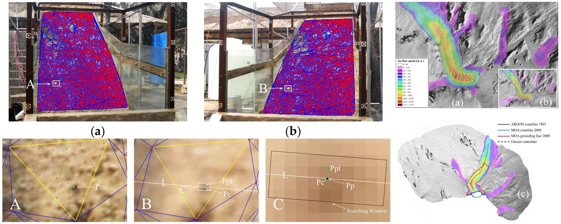
2. 弱纹理遥感影像的密集匹配方法研究:开发了集影像增强、金字塔分层、多条件约束的影像特征和格网匹配新方法,实现了弱纹理影像的密集匹配,应用于滑坡灾害立体监测;开发了基于视差分解的早期影像密集匹配新算法,应用于南极冰川三维测图;成果发表于Remote Sensing和IEEE Transactions on Geoscience and Remote Sensing等国际期刊。
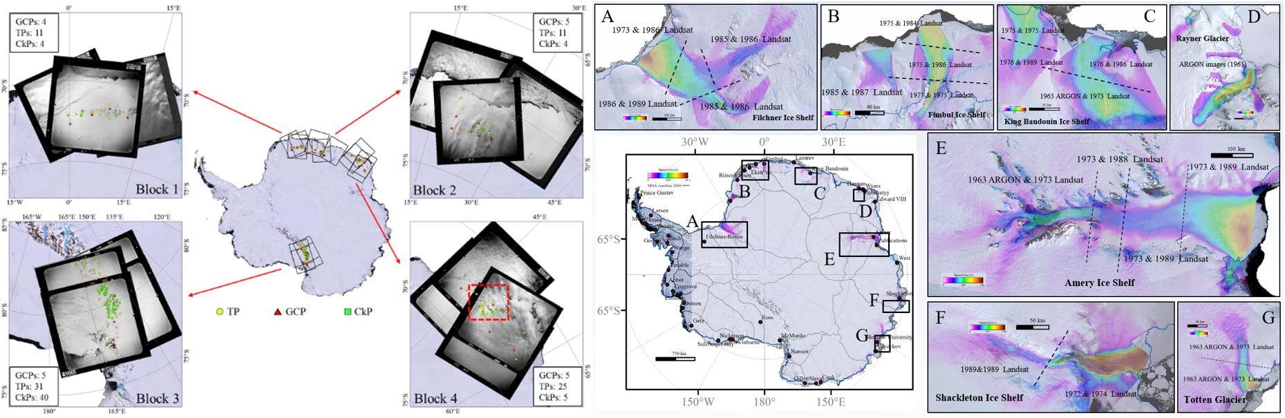
3.1960年代解密胶卷卫星影像的现代化摄影测量与南极冰流速度制图:提出了1960年代早期胶卷卫星影像的现代化摄影测量建模新方法,研制了1963年东南极典型区域冰流速度图,将国际上南极冰盖研究时间尺度向前拓展了30年;成果发表于Photogrammetric Engineering and Remote Sensing期刊。
4. 青藏高原湖泊遥感与全球变化研究:探明了青藏高原大型湖泊水质变化特征及其驱动机制,揭示了湖泊持续扩张对于永久冻土退化的加速作用及对气候变化的脆弱性响应;成果发表于Remote Sensing of Environment和Science of the Total Environment等国际期刊。
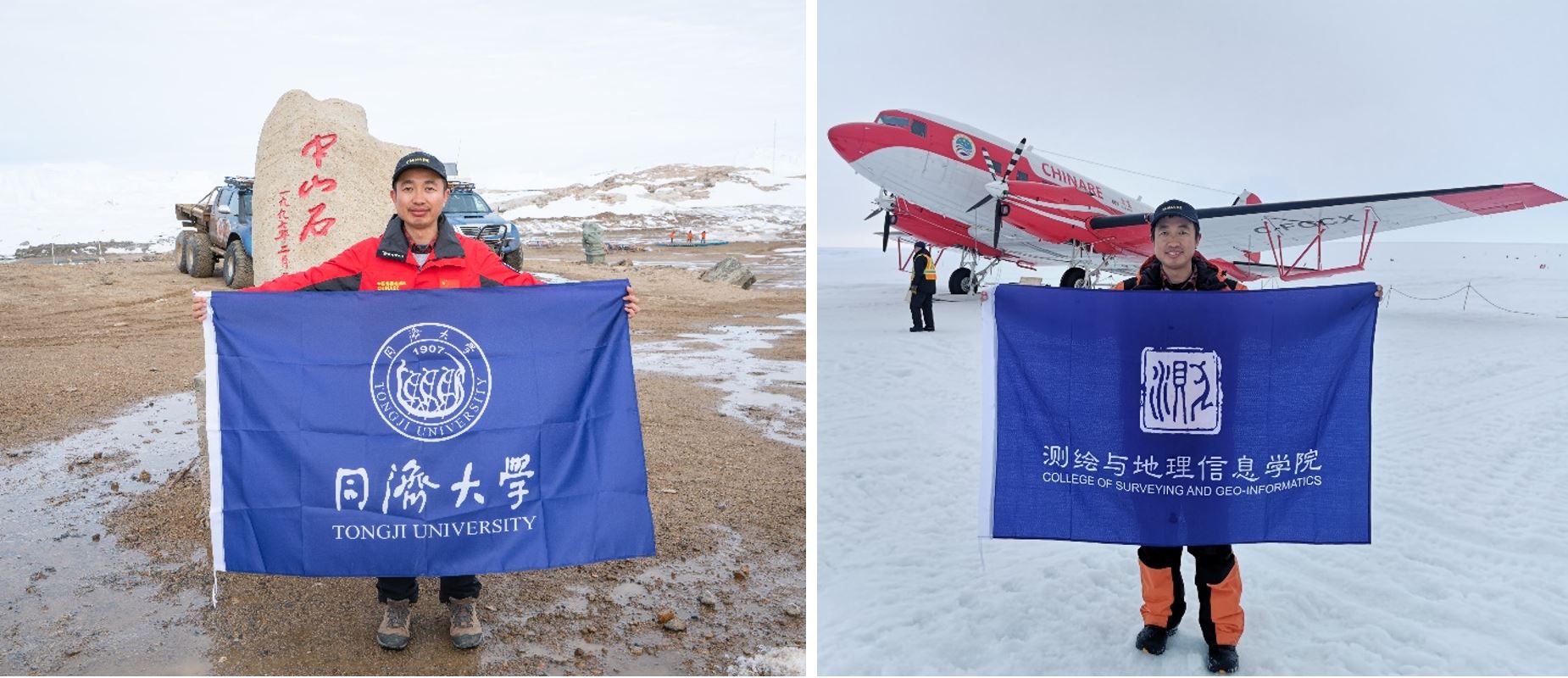
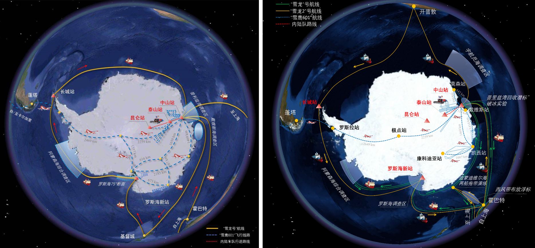
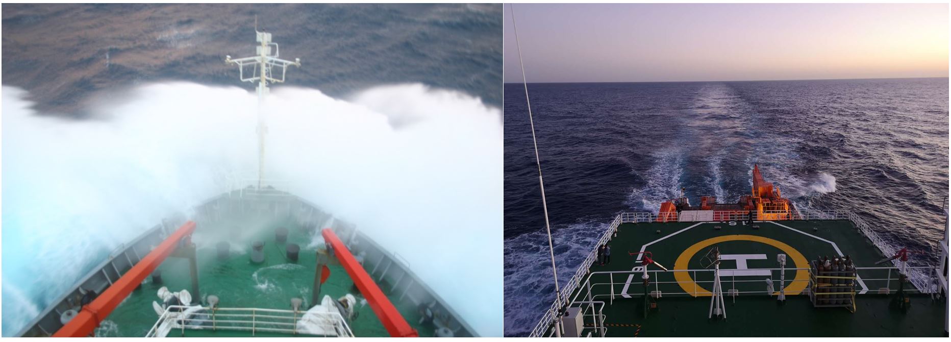
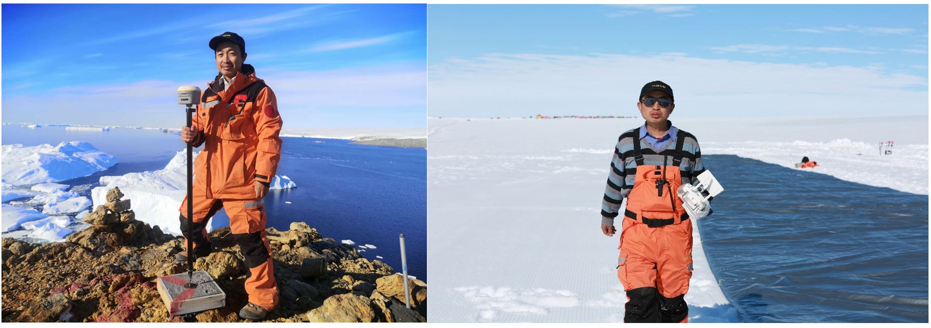
5. 极地科学考察 1)乔刚教授参加中国第35、36次南极科学考察 乔刚教授于2018-2020年间参加中国第35、36次南极科学考察,服务于国家南极战略和极地科普事业。第36次南极科学考察中山站卸货期间,依托测绘学院遥感团队为雪龙船规划破冰航线和冰面运输路线提供技术支撑并做出了重要贡献,考察队专门致函感谢同济大学的支持,本人被中国第36次南极考察队授予“优秀党员”称号。同济大学官网、人民日报、搜狐网、澎湃新闻等新闻媒体对南极科考活动进行了广泛报道,获得了公众的广泛关注。
2)博士生李洪伟参加中国第38次南极科学考察 博士生李洪伟于2021-2022年间参加中国第38次南极科学考察,开展南极冰盖边缘区域ICESat-2冰雪表面高程测量精度评估工作,为精确估计南极冰盖物质平衡对海平面上升贡献提供数据支撑。在中山站区域,基于机载光学、雷达以及热红外传感器,对拉斯曼丘陵内拉湾海冰、冰裂隙、熔池以及冰山进行动态观测,安装维护了20米冰雪温度链,开展了南极冰盖物质平衡关键参数观测,对验证极地数据产品精度起到了重要支撑作用。
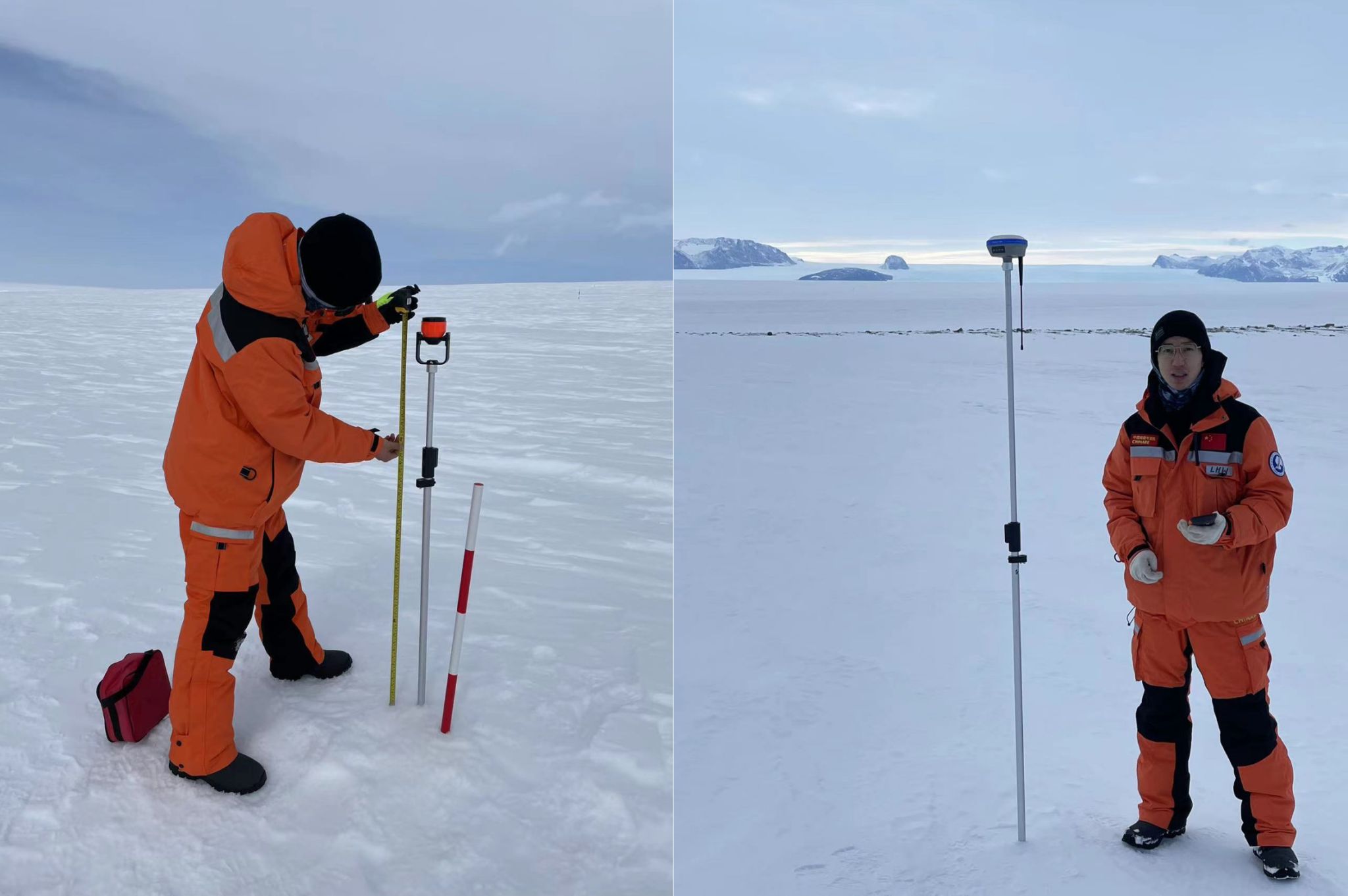
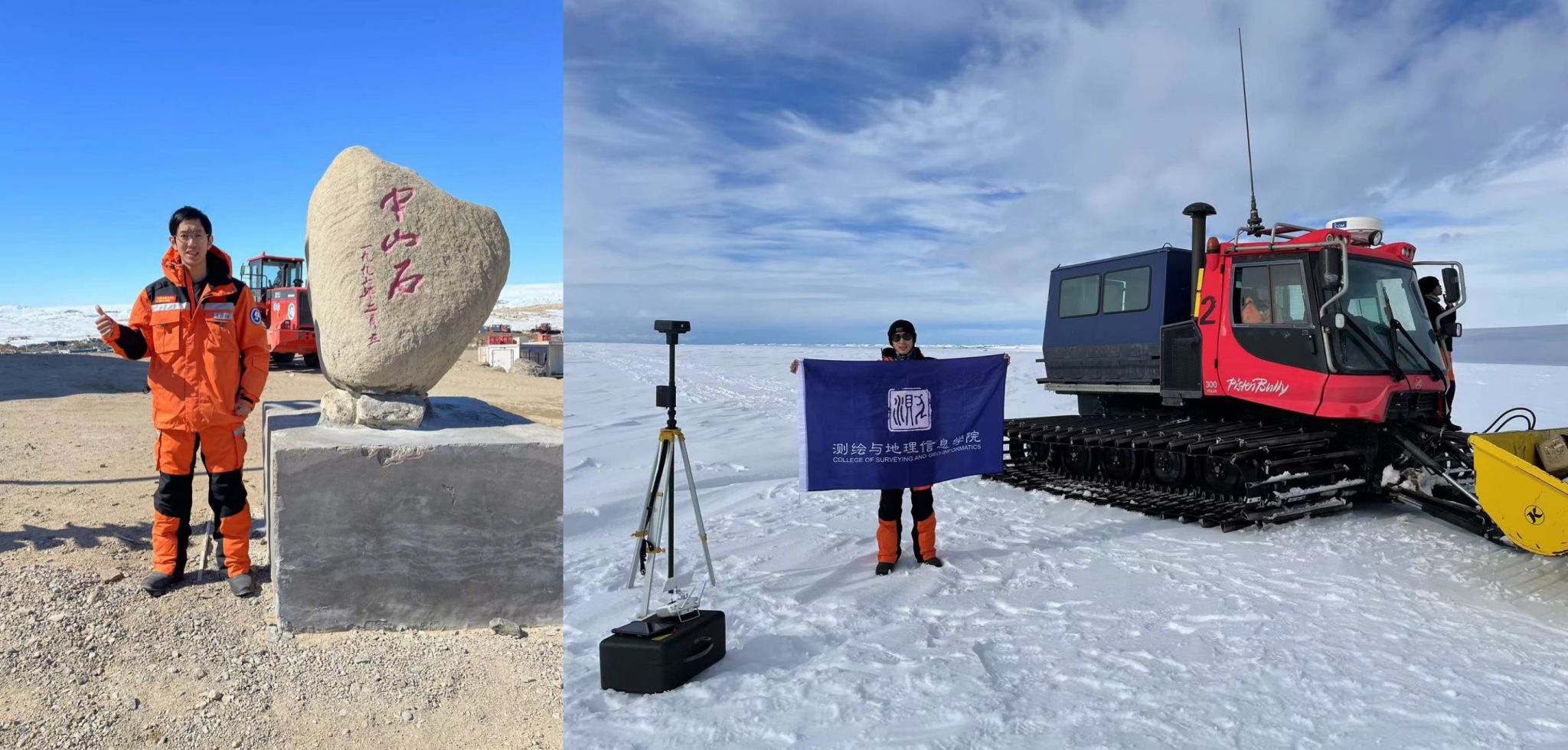
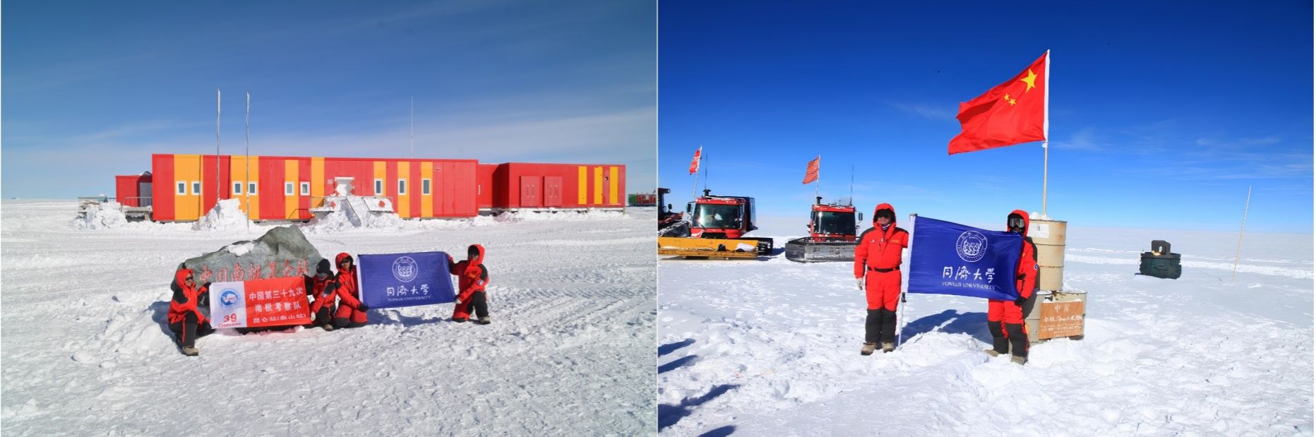
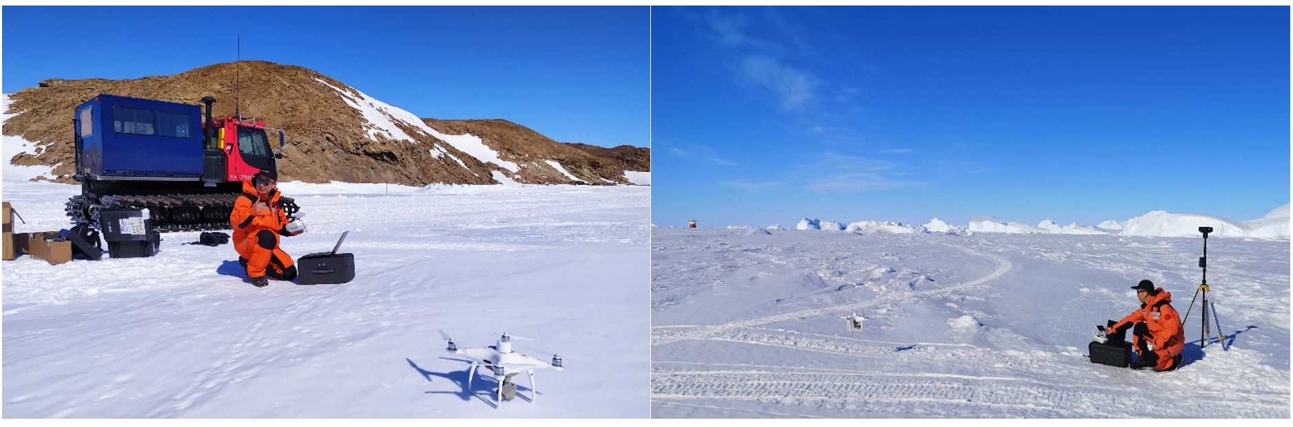
3)硕士生曹哲毅参加中国第39次南极科学考察 硕士生曹哲毅于2022-2023年间参加中国第39次南极科学考察,深入南极冰盖内陆1200千米,参与开展中山站-泰山站-昆仑站内陆沿线南极冰盖物质平衡与海平面上升贡献研究的地空观测。在中山站、昆仑站等周边区域,曹哲毅完成多项业务化观测项目,同时利用无人机平台对冰面微地形进行探测、分析与建模,为提取冰盖物质平衡与全球海平面变化关键参数提供基础。返校后受到同济大学官方公众号、青春上海、光明日报等媒体采访,其南极科考事迹展示了同济学子的家国情怀和使命担当。
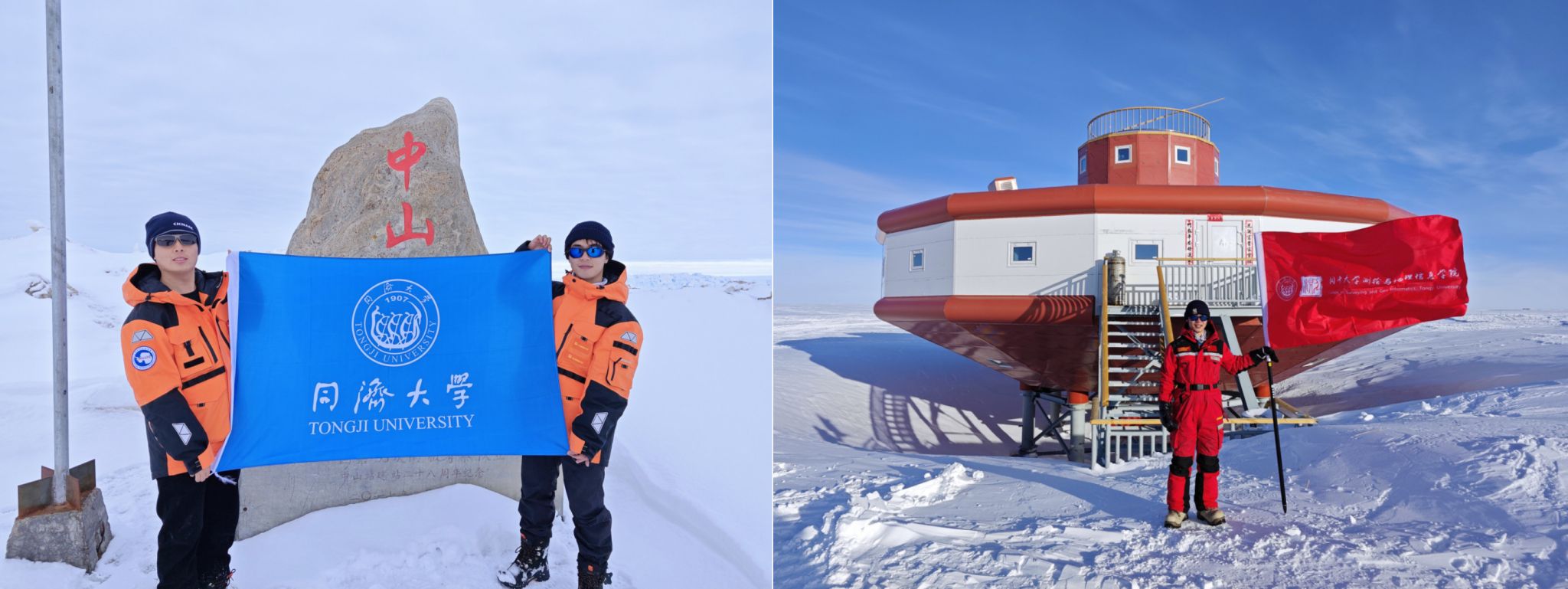
4)博士生谢陈雨参加中国第40次南极科学考察 博士生谢陈雨于2023-2024年间参加中国第40次南极科学考察,作为首位“00后”内陆队员,前往南极内陆格罗夫山地区,针对物质平衡关键参数及冰雪表面特征进行高精度测绘研究。考察期间,开展高精度无人机航空摄影测量,联合全波段地面光谱仪与光学卫星及无人机同步测定冰雪表面光谱曲线,通过地面及低空冰雷达探测冰雪浅层结构特征,基于高精度GNSS测量冰雪表面三维坐标等科学研究。基于国产高分辨率遥感卫星数据对格罗夫山地区行进路线以及麒麟冰下湖探路选线提供技术支持,为考察队安全行进做出了贡献。
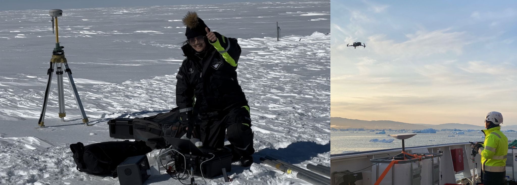
5)博士生袁小涵参加瑞典北极格陵兰科学考察和韩国ARAON科考船多国(瑞典)南极科学考察 博士研究生袁小涵在赴瑞典哥德堡大学联合培养期间,于2023年7月参加了瑞典哥德堡大学北极格陵兰科学考察,并于2023-2024年参加了韩国ARAON 科考船多国 (瑞典) 南极科学考察任务,聚焦于国际上格陵兰冰盖和南极冰盖冰-海热点区域(东格陵兰Sermilik峡湾Helheim冰川、西南极阿蒙森海Thwaites冰川、Dotson冰架等),开展在全球气候变化背景下的冰川前缘及冰腔内部海洋环境调查和冰川冰架的高分辨率建模及演化分析,探究冰川与海洋相互作用,服务于未来南北极典型区域冰川冰架结构的稳定性评估,及其稳定性变化对未来海平面上升贡献的预测。
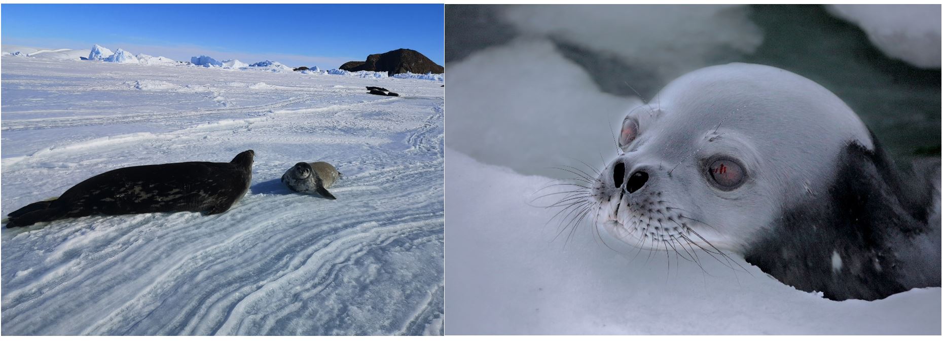
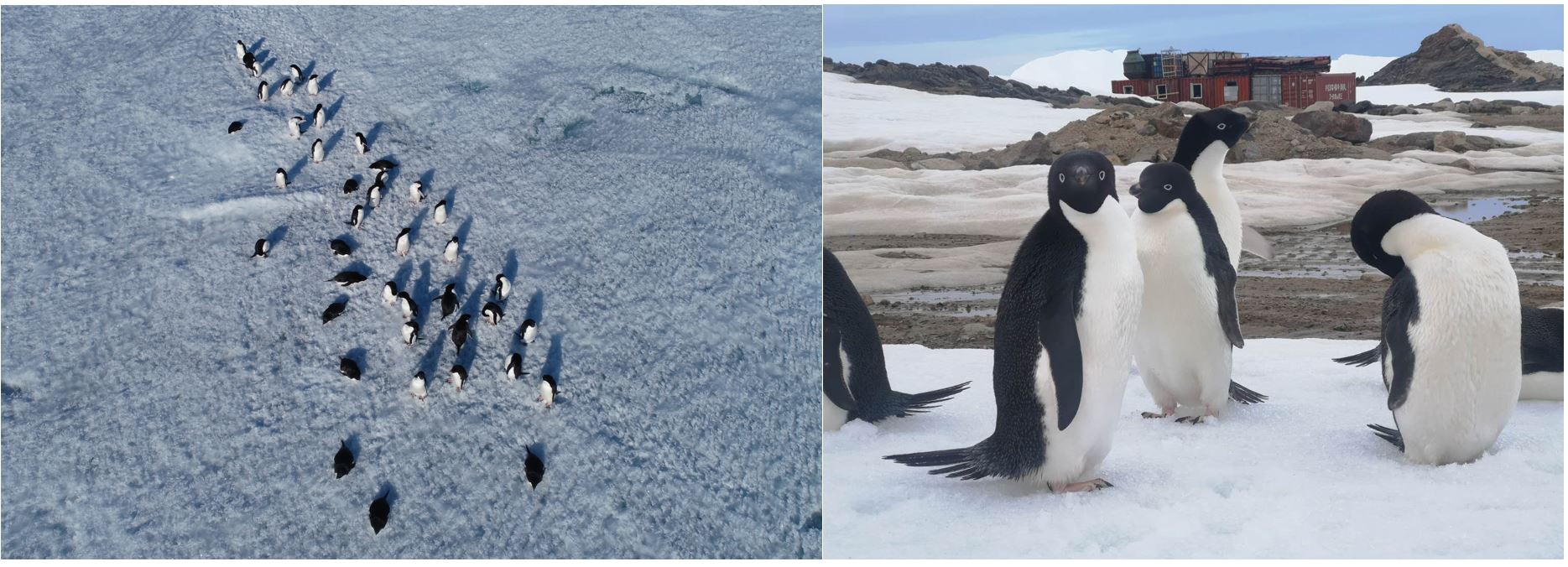
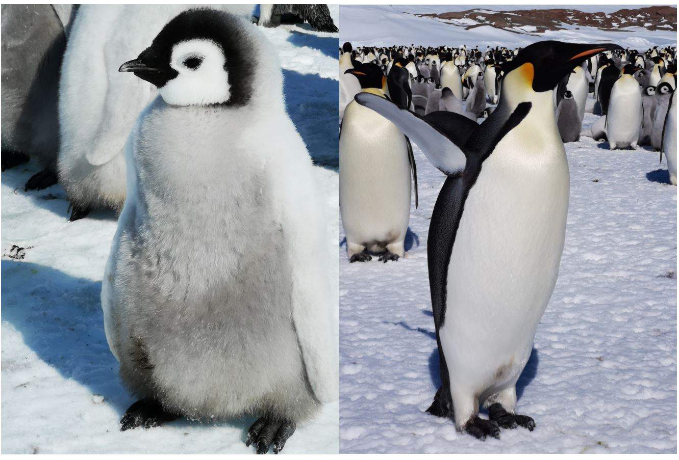
6. 中国第35、36次南极科学考察掠影 中国第35、36次南极科学考察航线
“雪龙”号、“雪龙2”号科考船南行
南极“海冰探路”与冰盖测绘
中山站与内陆出发基地
泰山站与“冰盖520机场”
“KA32”直升机与“海豚”直升机
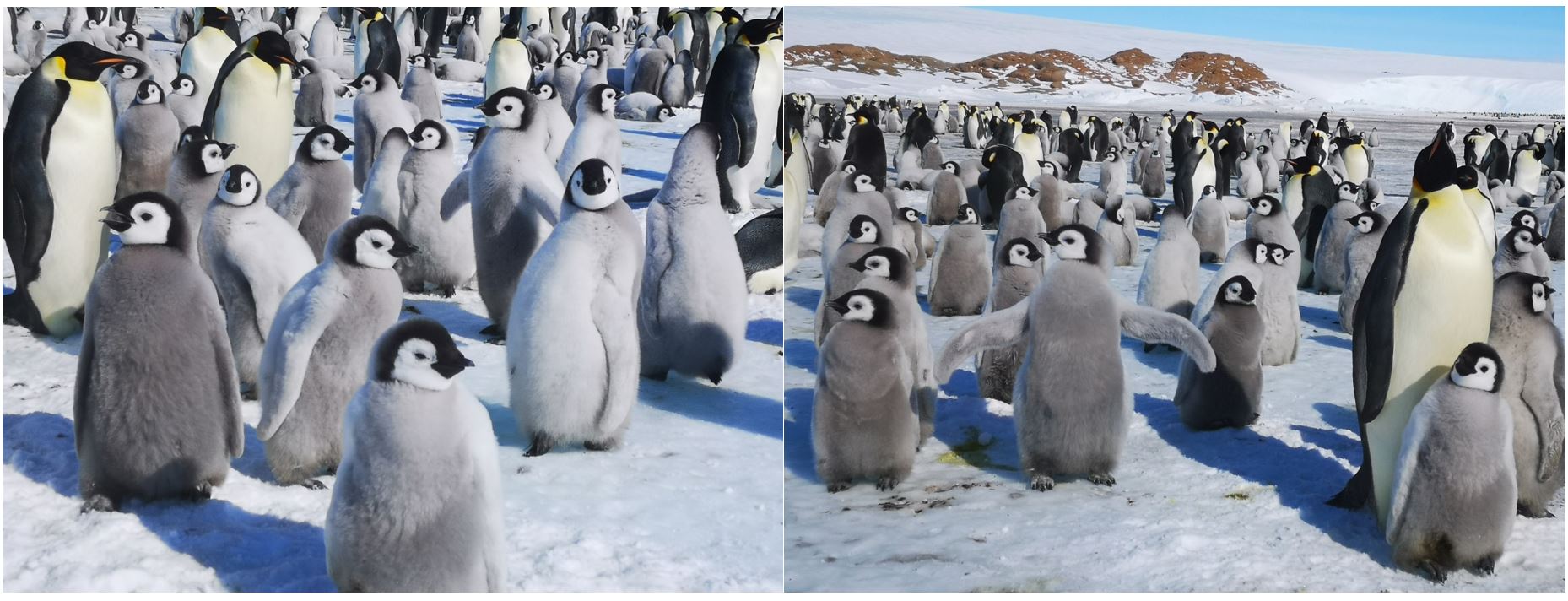
海豹与企鹅
|
|