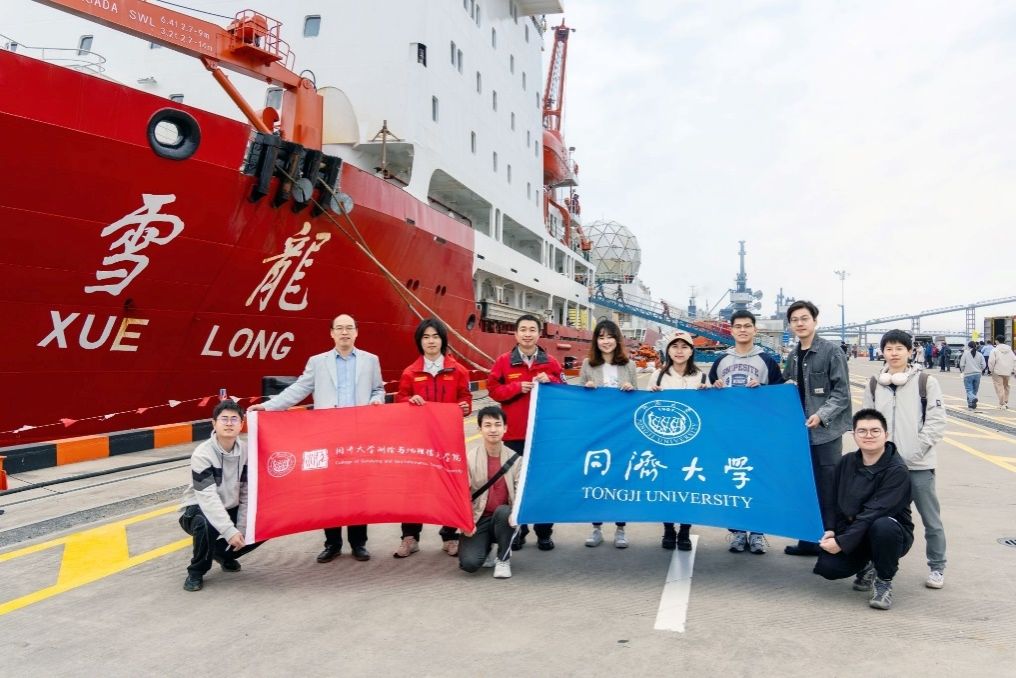
On April 15, 2024, after 167 days, Xie Chenyu, the firs team member of the Chinese Antarctic expedition team born after the year 2000 and the PhD student of the College of Surveying and Geo-Informatics, successfully returned to Shanghai aboard the "Snow Dragon" polar research vessel, completing China's 40th Antarctic scientific research mission satisfactorily.
Members of the 40th Chinese Antarctic scientific research mission returned to Shanghai. (Left three: Xie Chenyu)
Tongji University has long been involved in several major research projects in China's polar science field, participating in multiple polar expeditions, and consistently contributing to China's polar science research efforts. In this Antarctic scientific expedition, with the support and assistance from Tongji University, the Chinese Antarctic Research Center, and the Antarctic Inland Team, Xie Chenyu, a PhD student, embarked from Zhongshan Station with the inland team. The primary focus of the expedition was on conducting scientific investigations in the Rauer Hills area where Zhongshan Station is located, the Groves Mountains inland region, Taishan Station, the Qilin Subglacial Lake area, and along the expedition route.
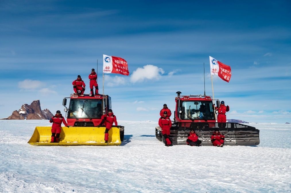
Group photo of the Inland Team in the Groves Mountains region. (Second from the left on the roof of the vehicle: Xie Chenyu)
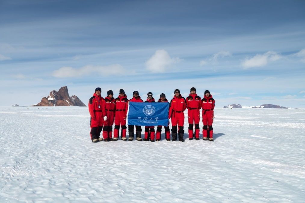
Group photo of the Inland Team in the Groves Mountains region. (Fifth from the left: Xie Chenyu)
During this inland expedition, which lasted a total of 62 days, Xie Chenyu completed numerous scientific research tasks along the Antarctic inland survey route. They collected a significant amount of valuable field observation data, which contributes to the establishment of a comprehensive observation system covering different types of regions, including polar areas. This data helps to improve the accuracy of material balance estimations in typical regions of the East Antarctic, validate critical scientific processes within the polar cryosphere, analyze elements of key cryospheric processes, enhance the estimation capabilities of critical parameters related to cryospheric material balance, and provide data support for reducing uncertainties in global climate change predictions.
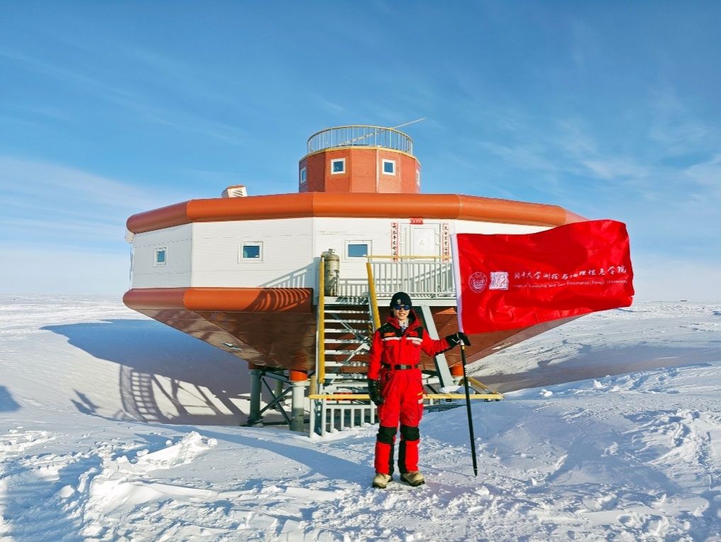
The Chinese Antarctic Taishan Station.
Key scientific achievements:
Along the inland survey route, a new type of SAR (Synthetic Aperture Radar) satellite corner reflectors was installed. Additionally, maintenance was conducted on five sets of satellite corner reflectors deployed during previous survey missions. These efforts provide ground-based validation data for the inversion of ice sheet movement speed from SAR satellite images.
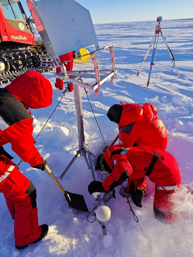
Maintenance of corner reflectors along the inland survey route. (Bottom right: Xie Chenyu)
Along the inland survey route, a new set of automatic temperature observation chains was installed, and multiple sets of temperature chains deployed during previous survey missions were maintained. This enabled the vertical temperature observation of critical parameters related to material balance and global sea level change. The data obtained supports the validation of temperature numerical models for firn densification and facilitates the observation of long-term trends in ice sheet temperature changes.
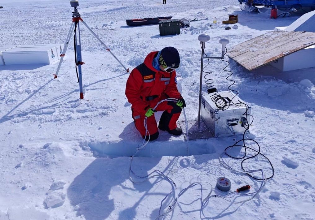
Deployment of temperature chains along the Antarctic inland survey route.
High-resolution unmanned aerial vehicle (UAV) photography was utilized to measure and analyze parameters such as micro-topography, spectra, and temperature on the surface of the ice sheet. This facilitated the acquisition of a large amount of surface terrain data and information on the location of ice and snow surfaces with centimeter-level accuracy. Additionally, it enabled the extraction of distribution and geometric attributes of geomorphic features such as ice flow velocity, ice crevasses, ice pits, and exposed rock outcrops in typical areas. As a result, the micro-topography of typical ice sheet surfaces was reconstructed.
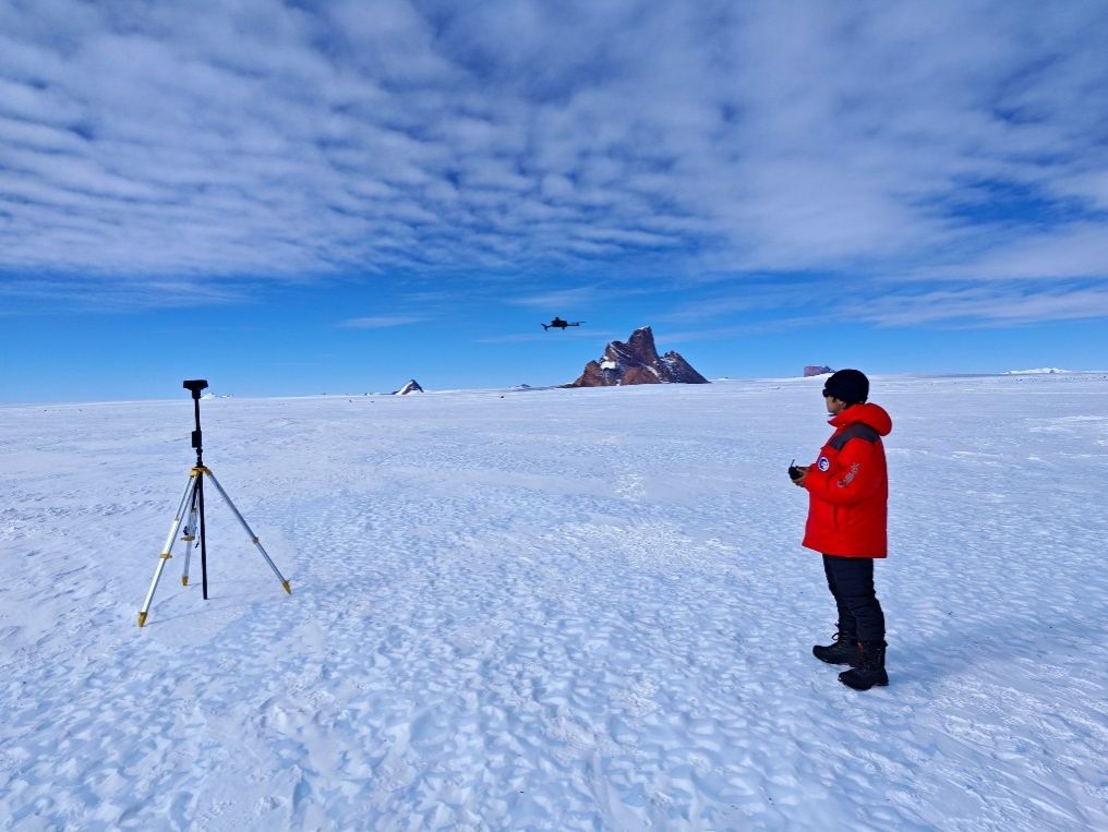
Data collection using UAV aerial photography in the Groves Mountains region.

Collection of multi-spectral data on ice crevasses in the Groves Mountains region using unmanned aerial vehicles (UAVs).
High-precision portable full-band spectrometers were utilized to collect spectral curves of the ice and snow surfaces, obtaining true spectral values for blue ice and firn surfaces. These data were integrated with satellite and UAV spectral data through coordinated observation, establishing a coordinated observation system across ground, air, and space. This system supports the identification and classification of different types of ice and snow on the ice sheet surface.
Data collection of spectral curves on blue ice in the Groves Mountains region.
A ground portable radar interferometer (GPRI) was installed at Zhongshan Station to conduct continuous on-site observations of material balance and key parameters related to global sea level change (such as ice flow velocity, micro-topography of ice and snow surfaces, and ice shelf disintegration) in the surrounding ice sheets and glaciers. This supports research on the instability of the East Antarctic ice sheet and uncertainties in sea level contribution.

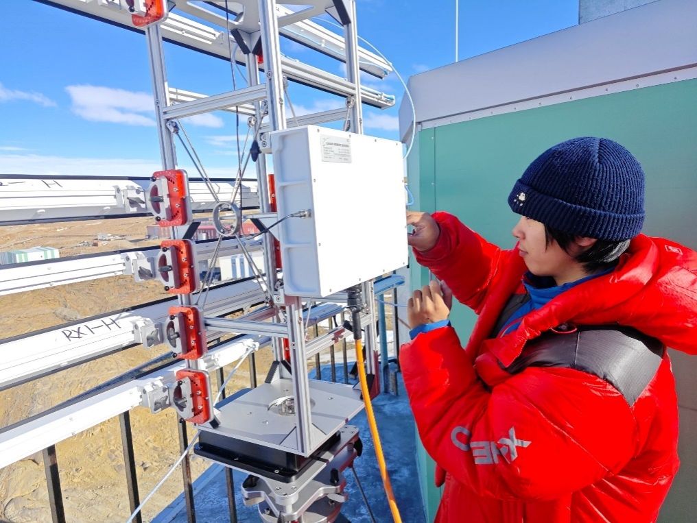
Continuous observation of key parameters of ice sheets and glaciers using a portable radar interferometer.
In the Qilin Subglacial Lake area inland, ground-based and UAV-based dual-mode detection using low-frequency ice-penetrating radar was conducted to obtain data on shallow artificial targets and internal crevasses of the ice sheet, supporting the inversion of internal ice sheet structure.
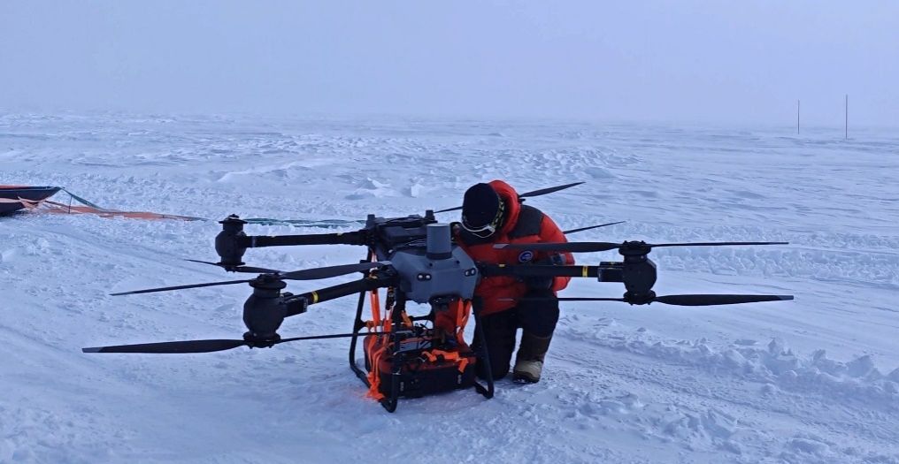
Airborne ice-penetrating radar detection in the Qilin Subglacial Lake area.
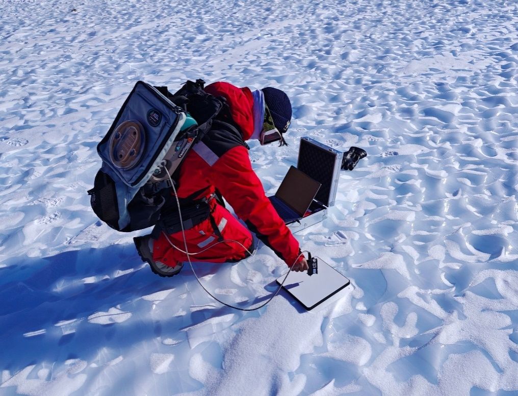
In typical inland regions and along the survey route, a large number of three-dimensional coordinates of ice surface features were collected using high-precision GNSS receivers, providing real and effective ground validation data for modeling key parameters of material balance.
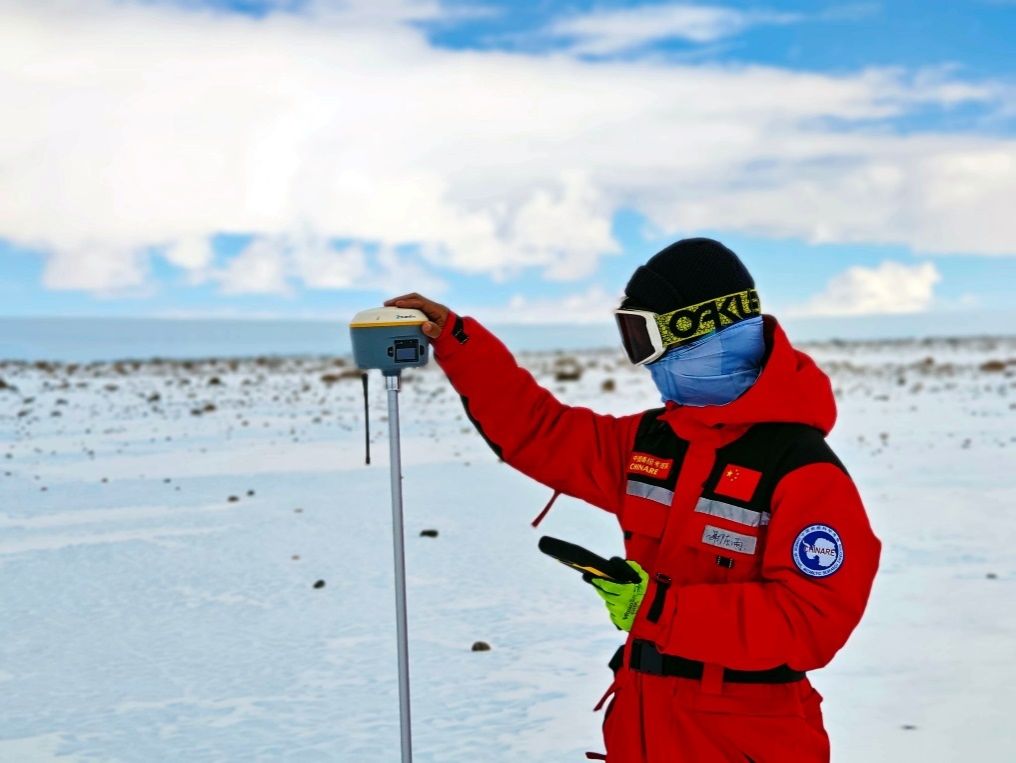
GNSS measurement in the Groves Mountains region.